
Curiosity Finds a Field of Tiny Polygons on Mars
The rover’s new images show how space work depends on measurement, chemistry, robotics, and careful interpretation from far away.
Print it — all four files
The student packet has no answers in it. The teacher copy is the same pages plus a note on each question and the answer keys. Both languages carry the same story, the same picture and the same vocabulary.
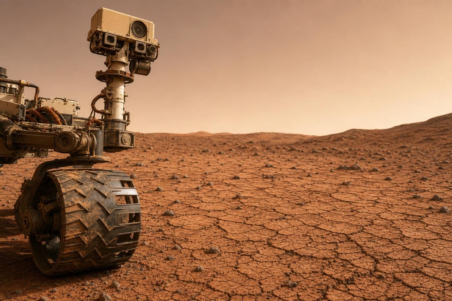
NASA’s Curiosity rover has sent back images of a large field of small polygon-shaped features on Mars, according to reporting by Phys.org. The rover found them in Gale Crater, the broad impact basin Curiosity has been exploring from ground level. A polygon is a shape with straight sides, like a triangle, rectangle, or hexagon; in this case, the features are natural surface patterns, not objects placed there. They measure about 4 to 8 centimeters across, or roughly 1.5 to 3 inches. Scientists do not yet know exactly how they formed, but one leading idea is that they are ancient mud cracks.
That matters because mud cracks form when wet material dries, shrinks, and breaks into patterns. On Earth, that can happen in a drying puddle, lakebed, or construction site after wet clay or mud loses moisture. On Mars, features like these may preserve evidence of wet and dry cycles from billions of years ago. Phys.org reports that earlier Curiosity observations in Gale Crater led researchers to suggest that similar cracks could have formed during the Noachian-Hesperian transition, a period about 3.8 billion to 3.6 billion years ago when some scientists think Mars may have had a more Earth-like climate.
The discovery is also a work story. Curiosity is a car-sized rover, which means it is a robotic field vehicle built to move, image, and test a landscape without humans standing beside it. On Earth, a field technician or geologist might walk over to a rock, kneel down, take measurements, and decide what to sample next. On Mars, that job becomes remote operations: a team has to use images, instrument readings, and careful planning to decide what the rover should examine. The work is slower than walking a jobsite, but it also has to be extremely precise because every movement and measurement must be planned across interplanetary distance.
The article says mission scientists measured the shapes and chemistry of the polygon field. Chemistry here means the makeup of the material: which elements or compounds are present, and how they compare with nearby surfaces. Shape matters too. A crack pattern made by drying mud can look different from one made by freezing and thawing, or from one caused by stress in rock. Scientists are considering mud cracking as a leading explanation, but Phys.org notes that other polygonal features on Mars may form from freeze-thaw cycles, tectonic stress, or volcanic stress. Tectonic stress means pressure from movement or strain in a planet’s crust, while volcanic stress means pressure and deformation linked to volcanic activity.
Curiosity’s ground-level view is important because Mars has also been studied from orbit. NASA’s High Resolution Imaging Science Experiment, or HiRISE, is a camera system on an orbiter that has been circling Mars since 2006 and taking detailed images from above. Orbital images are a kind of remote sensing, which means collecting information about a place without touching it directly. HiRISE has seen much larger polygons elsewhere on Mars, including features ranging from 15 meters to more than 350 meters across. Curiosity’s new polygons are much smaller, and the rover can look at them from the surface instead of only from overhead.
For CTE pathways, the key point is that this kind of space work is not just one job called scientist. It is a chain of technical work: instruments have to function, images have to be processed, surfaces have to be measured, and data has to be compared with possible explanations. A robotics-focused worker would care about how a rover safely moves and positions itself. An electronics or instrumentation worker would care about sensors, cameras, power, and reliability. A geospatial or imaging worker would care about scale, resolution, and how a picture becomes useful evidence. A lab or materials-minded worker would recognize the importance of chemistry data before making a claim about what happened.
The job also shows how uncertainty works in technical fields. The team did not simply label the polygons as mud cracks and move on. The article says more work is needed to understand their formation processes. That is a professional standard, not a weakness. In skilled trades and technical careers, a first diagnosis can be useful, but it has to be checked against measurements. A mechanic does not replace a part just because a sound suggests one cause. A welder does not assume a crack came from one problem without looking at stress, material, and heat history. In the same way, Mars researchers compare the pattern, size, location, and chemistry before deciding what explanation fits best.
Curiosity’s find is a reminder that old surfaces can still hold useful information if the right tools are used carefully. Mars today is cold and dry, but its surface may preserve signs of older conditions because it lacks some of Earth’s resurfacing processes, such as plate tectonics and flowing water. The rover cannot bring a person to the polygon field, but it can turn a distant landscape into a technical problem: capture the image, measure the pattern, test the chemistry, compare possible causes, and decide what should be examined next.
Written from reporting by Phys.org, “Mars Curiosity rover discovers massive field of polygons”.
Discussion questions
- When a remote machine finds something unusual, how much evidence should a team collect before naming a likely cause, and what are the risks of waiting too long versus deciding too quickly?
- Which CTE pathway skill set seems most central to this discovery: robotics, electronics and instrumentation, imaging and geospatial analysis, or materials and chemistry? Defend your choice.
- How is diagnosing a Martian surface feature similar to troubleshooting a machine, structure, or system on Earth, and where does the comparison break down?