
Ocean Sensors Head to an Old Tsunami Source
A research team will study an Alaska fault system with seafloor instruments that must survive deep water for 15 months.
Print it — all four files
The student packet has no answers in it. The teacher copy is the same pages plus a note on each question and the answer keys. Both languages carry the same story, the same picture and the same vocabulary.
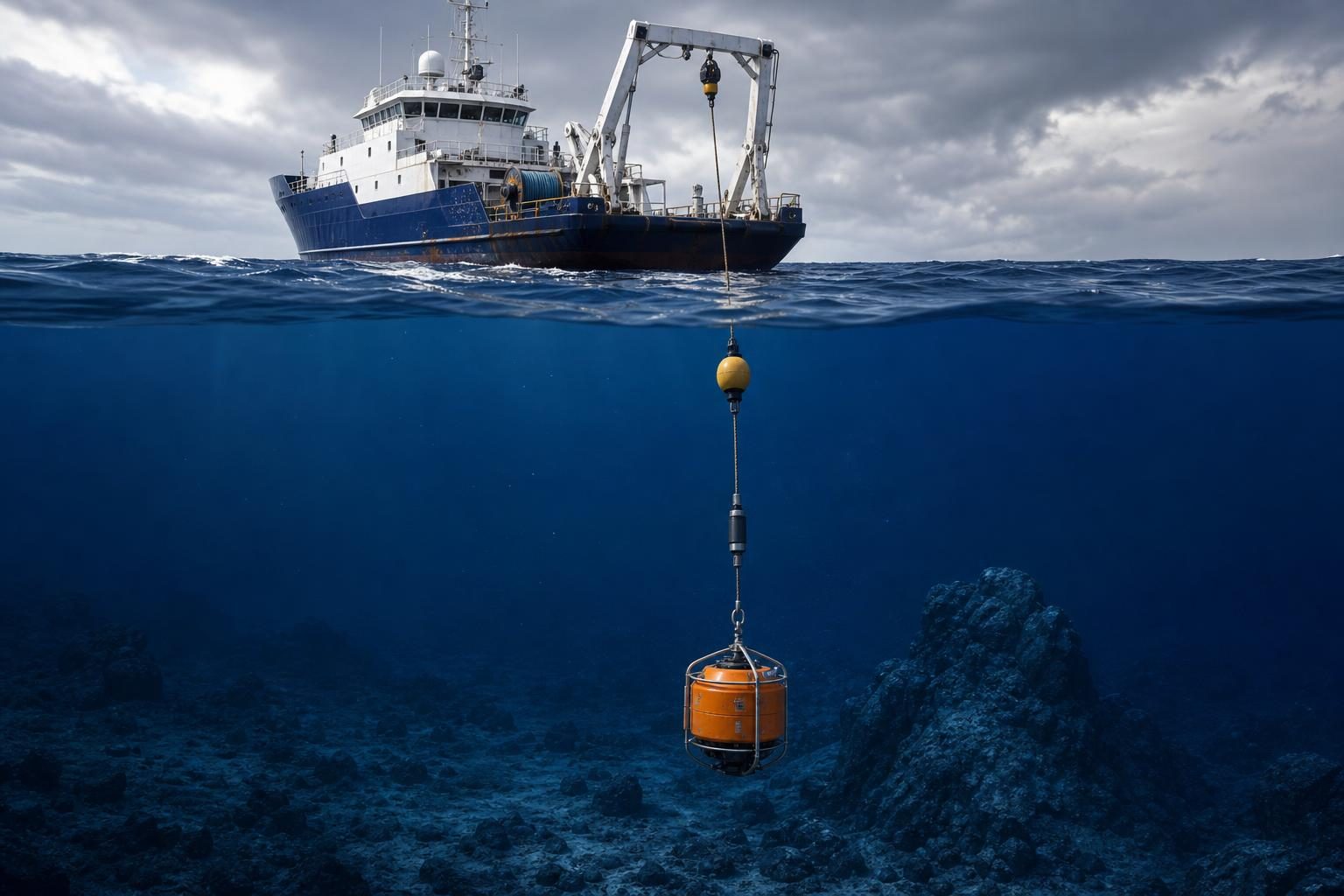
A Michigan State University research team is preparing to study the undersea fault system linked to a deadly 1946 tsunami that struck parts of Hawaii, Alaska, Washington, and Oregon, according to Phys.org. The team plans to place waterproof seismometers, instruments that measure ground vibrations from earthquakes, on the bottom of the Pacific Ocean near Alaska. The goal is not to predict the next earthquake. It is to collect better data on how this section of Earth is moving now, so scientists can improve risk maps and the building codes that use them.
The site matters because the 1946 tsunami, a series of powerful ocean waves caused when the seafloor suddenly moves water above it, was unusual. Phys.org reports that it followed a relatively small earthquake off Alaska, and seismologists, the scientists who study earthquakes, still do not fully understand why it produced such a large tsunami. The project focuses on the Alaskan-Aleutian subduction zone, a place where one tectonic plate, or huge moving slab of Earth’s outer shell, dives beneath another plate. These zones can produce major earthquakes because plates can stick, build stress, and then suddenly slip.
The work is part science, part marine operations, and part precision instrument deployment. Songqiao “Shawn” Wei, an associate professor in earth and environmental sciences and computational mathematics, science, and engineering, will lead the effort with partners from the University of Hawaii. The project has National Science Foundation support, including ship time and instrument use. That matters because ocean-bottom work costs more and takes more planning than land-based monitoring. On land, a sensor can use solar power and GPS, which is a satellite-based system for location and timing. Deep underwater, solar panels do not help and GPS signals do not reach the instrument.
That changes the job. Before a research vessel leaves port, the team must study the seafloor and choose locations that are smooth, flat, and free of rocks. A bad site can damage equipment or produce poor data. During deployment, the crew uses a flotation system so each seismometer drops slowly instead of crashing into the seabed. Phys.org reports that placing just one sensor can take hours. The instrument then has to run on a battery for about 15 months, using atomic clocks, extremely precise timekeeping devices, to time each vibration it records. After that, the team must return by ship, recover the equipment, and download the data.
For a CTE classroom, the project is a good example of how modern science depends on technicians and operators as much as on professors. Someone has to prepare sealed housings so water pressure does not ruin electronics. Someone has to handle deck operations safely on a ship. Someone has to manage batteries, clocks, cables, lifting gear, and recovery systems. Someone has to process large data sets after the instruments come back. The article does not list job postings or credentials, but the tasks point to a workforce that needs mechanical judgment, electronics knowledge, marine safety habits, mapping skills, and computer-based data analysis.
The data itself is not just a record of shaking. Seismic waves, which are vibrations traveling through Earth, can help scientists image what is below the seafloor, somewhat like medical imaging uses waves to see inside the body. Wei’s team is especially interested in water trapped deep within Earth and whether it changes friction, the resistance between surfaces when they try to slide past each other, between tectonic plates. That friction may affect whether a rupture, the section of a fault that breaks during an earthquake, stops quickly or grows into a larger event.
The researchers also want to study slow earthquakes. A slow earthquake is movement on a fault that takes days or weeks instead of seconds, releasing energy without the violent shaking of a typical earthquake. Scientists have only recognized these events in recent decades. Wei wants to know whether slow earthquakes are connected to the strange 1946 event and why they appear to occur in this part of the Aleutian system. That question cannot be answered by a short lab test, because the real materials, water, pressure, and plate motion are happening miles offshore.
The public-safety connection is practical. The U.S. Geological Survey uses science like this to update risk maps, which show how likely strong shaking is in different places. Engineers, planners, and code officials can use those maps when deciding how structures should be designed. Building codes are rules that set minimum safety standards for construction, such as how strong a structure must be to handle shaking. Better data does not eliminate risk, but it can change what builders, inspectors, emergency managers, and coastal communities prepare for.
This kind of project also shows why technical careers keep changing. The core problem is ancient: Earth’s plates move, faults slip, and coastlines face hazards. The tools are changing fast: long-duration batteries, precision clocks, waterproof pressure housings, ocean-floor mapping, and computer models that turn raw vibrations into useful information. The work requires patience because the instruments may sit silently for more than a year before anyone sees the data. It also requires humility, because a sensor can be well designed and still meet a seafloor that is rougher, deeper, or more complicated than expected.
Written from reporting by Phys.org, “Scientists to probe the source behind a massive 1946 tsunami”.
Discussion questions
- If funding were limited, should public money go first to more ocean-bottom sensors, stronger coastal warning systems, or stricter building codes? Defend your priority.
- What parts of this project seem most likely to require skilled trades or technical workers rather than only academic scientists, and why?
- How should engineers and code officials use uncertain science when they have to make real safety decisions before all the data is in?