
Free activities › Middle school
A Powerful Pacific Cyclone Starts a Storm Season
Satellite data showed Cyclone Xavier grow fast over warm water in a region shaped by El Niño.
Print it — all four files
The student packet has no answers in it. The teacher copy is the same pages plus a note on each question and the answer keys. Both languages carry the same story, the same picture and the same vocabulary.
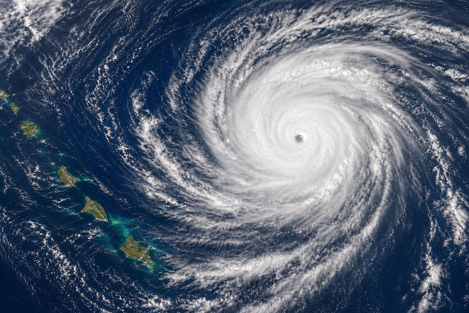
A powerful storm named Xavier formed in the Southwest Pacific this week and quickly became one of the strongest November tropical cyclones the region has seen in decades, according to NASA’s Earth Observatory. A tropical cyclone is a huge spinning storm that forms over warm ocean water; in different parts of the world, similar storms may be called hurricanes, typhoons, or cyclones.
The storm began as a tropical disturbance, which is an area of unsettled stormy weather, northeast of Samoa and the Cook Islands. The Fiji Meteorological Service started issuing updates about it on November 15. Within a few days, it had grown into a major cyclone. Xavier was the second named storm of the Southwest Pacific season, after a short-lived storm named Wati in October. A storm basin is a part of the ocean where weather agencies track storms as one group.
Xavier strengthened because several weather ingredients lined up. The sea surface temperature was about 84 degrees Fahrenheit, warm enough to help a cyclone grow. The storm also faced very little wind shear. Wind shear means winds are blowing at different speeds or directions at different heights in the atmosphere. Too much wind shear can tear a storm apart. With little wind shear, Xavier could organize and build strength more easily.
NASA satellites also saw the storm near a large stretch of unusually warm water across the Pacific. That warmth was a sign of El Niño, a natural climate pattern that changes ocean temperatures and weather around the world. During El Niño years, research shows that storm activity in this part of the Pacific often shifts northeast. Research also shows El Niño can help some storms strengthen very quickly.
On November 17, NASA’s Aqua satellite captured an image of Xavier. At that time, forecasters estimated its strongest winds at about 120 miles per hour. Later that day, the winds reached about 140 miles per hour. That made Xavier a Category 5 storm on the cyclone scale used in that region, and a Category 4 storm on the Saffir-Simpson scale, which is the scale often used for hurricanes in the United States.
Colorado State University hurricane expert Phil Klotzbach noted that Xavier was the strongest November tropical cyclone east of the International Date Line on record. The International Date Line is an imaginary line in the Pacific Ocean where the calendar date changes by one day. Xavier formed near the northern Cook Islands, farther east than usual for this region.
The storm caused damage to homes and knocked out power as it passed the northern Cook Islands, according to news reports cited by NASA. After that, Xavier moved into drier air and stronger wind shear, so it slowly weakened. That reduced the danger for Samoa and American Samoa.
The story matters beyond one storm because it shows how scientists connect daily weather to larger climate patterns. In science class, weather is what happens over hours or days, while climate is the long-term pattern over many years. Satellites help scientists measure clouds, ocean warmth, and storm shape from space. Those measurements help forecasters warn communities before a storm arrives.
More storms may follow. The Fiji Meteorological Service’s seasonal outlook says the Southwest Pacific region could see between 11 and 15 named tropical cyclones this season. Storm activity there usually peaks in February. Xavier was an early reminder that a quiet season in one ocean does not mean the whole planet is quiet.
Written from reporting by NASA, “The Stormy Southwest Pacific”.
Discussion questions
- When a storm grows unusually fast, what information should forecasters share first with the public, and why?
- How does satellite data change what people can know about storms compared with only using observations from land or ships?
- Should communities in storm-prone areas plan mainly for the average season, or for the worst storms that might happen? Defend your choice.