
Antarctic Radar Points to the Future of Forecasting Work
Hourly wind data from a remote radar improved test forecasts, showing why weather jobs are becoming more instrument-and-data driven.
Print it — all four files
The student packet has no answers in it. The teacher copy is the same pages plus a note on each question and the answer keys. Both languages carry the same story, the same picture and the same vocabulary.
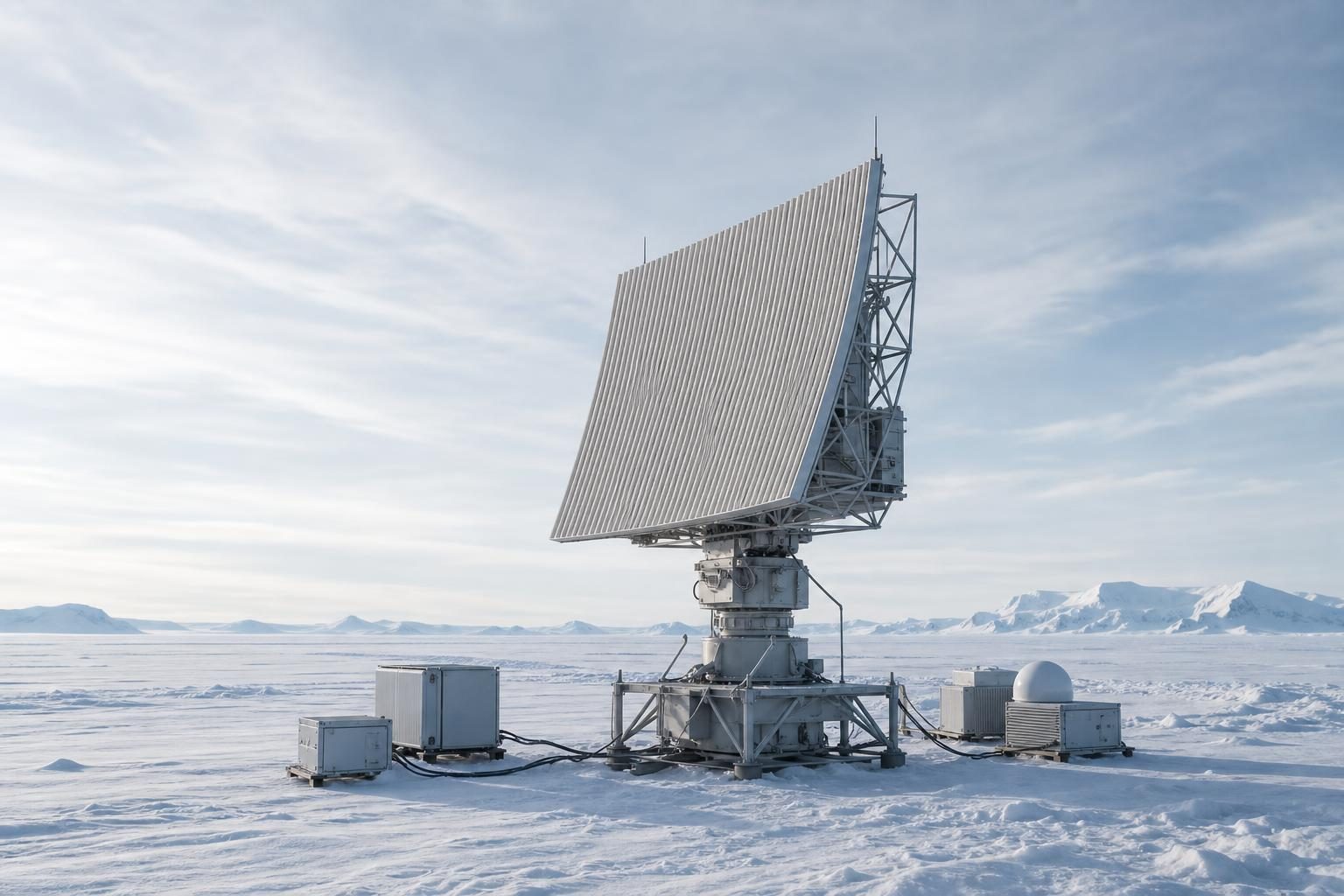
Researchers found that hourly wind observations from an Antarctic radar improved test weather forecasts for the Southern Hemisphere, according to reporting by Phys.org on a new study in Scientific Reports. The team compared forecasts made with and without data from the PANSY radar at Japan’s Syowa Station in Antarctica. In tests covering seven atmospheric river events during the 2022 austral winter, the forecasts that included the radar data had lower prediction errors than forecasts based only on conventional observations.
That matters because Southern Hemisphere forecasts are generally less accurate than Northern Hemisphere forecasts. The reason is not that the atmosphere is simpler in one half of the planet. It is that Antarctica and the Southern Ocean have far fewer weather observations feeding the models. A forecast model is a computer system that uses physics and current observations to estimate what the atmosphere will do next. If the starting information is thin, even a powerful model can get the next steps wrong.
The study focused on atmospheric rivers, which are long, narrow bands of water vapor moving through the sky. When they reach land or colder regions, they can bring heavy rain, snow, flooding, and strong winds. The article notes that these systems affect places including Australia, New Zealand, South America, and Antarctica. Better forecasts can help emergency managers prepare, but they also matter for transportation work such as aviation and shipping, where route planning depends on wind, visibility, storms, and timing.
The work behind this finding is not just one job. It is a chain of technical roles. Someone has to maintain the radar in a remote, cold environment. Someone has to make sure the instrument is measuring wind correctly and continuously. Someone has to handle the data stream. Someone has to combine that data with other observations inside a numerical weather prediction system, which is the software-and-math setup that produces forecasts. Someone else has to interpret the output and turn it into useful guidance for pilots, ship operators, research teams, and public agencies.
The PANSY radar measures wind conditions in the atmosphere much more often than weather balloons can in Antarctica. A radiosonde is a small instrument package carried upward by a weather balloon to measure conditions such as wind, temperature, and humidity. Radiosondes are a standard tool in forecasting, but the article says frequent launches in Antarctica are difficult because of cost and operations. Radar does not replace every weather balloon, but it can provide continuous, high-temporal-resolution observations, meaning measurements taken often enough to catch changes that might be missed between balloon launches.
The key technical step is called data assimilation. In plain terms, data assimilation is the process of feeding real observations into a forecast system so the model’s starting picture of the atmosphere is closer to reality. In this study, researchers used ALEDAS, a data assimilation and forecasting system developed and managed by the Japan Agency for Marine-Earth Science and Technology on its Earth Simulator supercomputer. They ran comparisons with and without the PANSY radar observations while also using enhanced radiosonde data from a polar prediction campaign.
The results show why weather careers are moving deeper into sensors, coding, and data quality. Adding the Antarctic radar observations improved the representation of wind speed, temperature, and geopotential height over Antarctica and the Southern Ocean. Geopotential height is a way meteorologists describe the height of pressure levels in the atmosphere, which helps show the shape and movement of weather systems. The presence or absence of the radar data produced a difference of more than 30% in atmospheric river moisture transport, which is the movement of water vapor by winds.
For CTE pathways, the important point is that modern forecasting is not only a person looking at clouds or reading a map. It is field instrumentation, electronics, networking, software, quality control, and operations under pressure. A technician on a project like this needs to be careful with calibration, power, maintenance logs, and harsh-weather procedures. A data worker needs to understand how bad or missing readings can affect a model. A forecaster needs enough science knowledge to judge whether the model output makes sense for the real world.
The study also shows a trade-off that employers and agencies face. Antarctica is expensive and difficult to observe, but uncertainty there can spread into forecasts far from the continent. If continuous radar observations can improve forecasts across the Southern Hemisphere, then investment in remote instruments may pay off in better decisions elsewhere. The article also notes that better Antarctic observations could improve reanalysis datasets, which are reconstructed records of past weather used in climate research, including studies of the Antarctic Ice Sheet’s surface mass balance.
The finding is still based on tests, not a worldwide operational change. The article says PANSY radar observations are not currently incorporated into operational numerical weather prediction systems. But the direction is clear: better forecasts increasingly depend on people who can keep instruments running, move reliable data, and connect field measurements to high-performance computing. In weather work, the tool bench now includes both hardware in the cold and models running on supercomputers.
Written from reporting by Phys.org, “Antarctic radar data improves forecasts for Southern Hemisphere atmospheric rivers in tests”.
Discussion questions
- If a weather agency has limited funding, should it prioritize more remote instruments like Antarctic radar, better supercomputers, or more forecasters? Defend your choice.
- What risks come with relying more heavily on continuous automated instruments in places where people cannot easily inspect or repair them?
- How could the same idea from this story—better upstream data improves downstream decisions—apply in another CTE field such as welding, automotive technology, health care, or construction?