
Free activities › Middle school
A Skull-Shaped Island Shows Signs of Antarctic Ice Loss
NASA images of Vega Island reveal bare ice, shrinking glaciers, and a spooky-looking lesson in climate science.
Print it — all four files
The student packet has no answers in it. The teacher copy is the same pages plus a note on each question and the answer keys. Both languages carry the same story, the same picture and the same vocabulary.
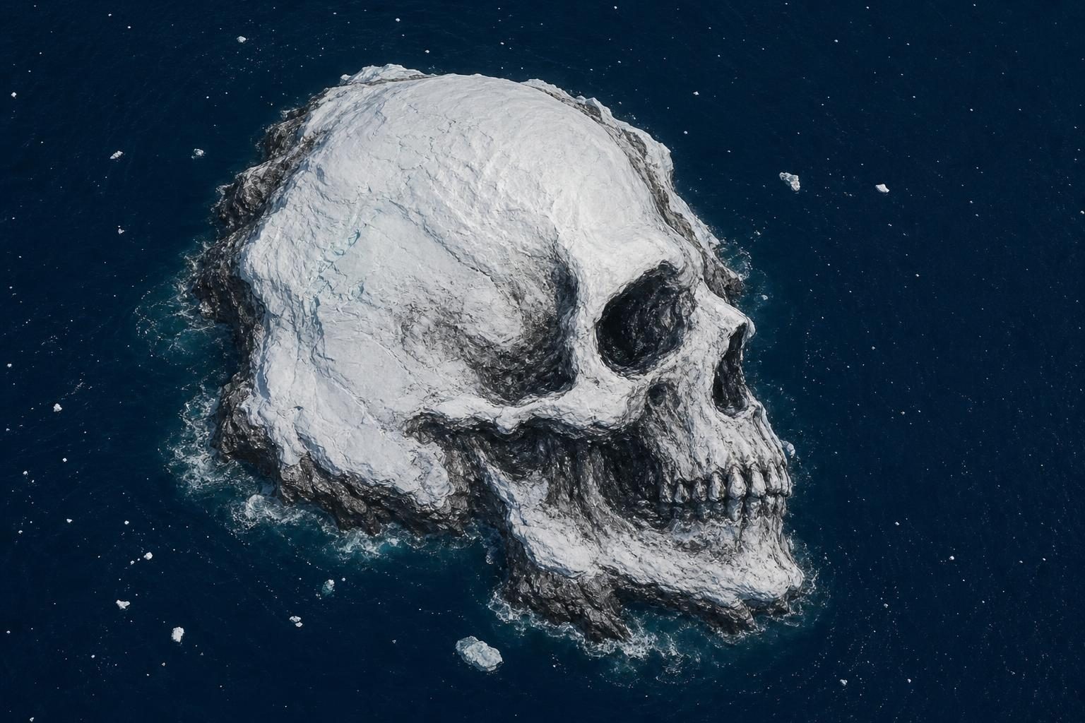
NASA has shared new satellite images of Vega Island, an icy island near the Antarctic Peninsula, that looks a little like a skull in profile. According to NASA Earth Observatory, the strange face is made by real land and ice features: rock sticking through ice, piles of glacier-carried rocks, and a glacier that shapes what looks like a jaw.
The image is fun to look at, but the science behind it is serious. NASA compared a Landsat 9 satellite image from March 22, 2025, with one from October 10, 2026. Landsat is a series of satellites that take pictures of Earth so scientists can study land, water, ice, and plants over time. The 2026 image showed large areas of darker, bare ice where snow was missing.
That matters because snow and ice do not act the same way in sunlight. Fresh snow is bright, so it reflects a lot of sunlight back into the sky. Bare ice is darker, so it absorbs more solar energy. When ice absorbs more energy, it can melt faster as the days grow longer and warmer.
Glaciologist Mauri Pelto of Nichols College told NASA that above-average winter temperatures in 2026, especially in June, helped leave so much bare ice by October. A glaciologist is a scientist who studies glaciers, which are huge, slow-moving masses of ice. Pelto also pointed to limited new snowfall, plus sublimation and wind scouring. Sublimation means snow or ice changes straight into water vapor without melting into liquid first. Wind scouring means strong winds scrape loose snow away.
The spooky look comes from several landforms. A nunatak, which is a rocky peak that sticks up through ice, looks like an eye socket. A lateral moraine, which is a ridge of rocks and dirt pushed along the side of a glacier, forms a mouth shape. Devil’s Bay Glacier makes the jawbone shape. These features are not alive, of course, but together they show how ice and rock can create patterns that the human brain quickly turns into faces.
Scientists have studied Vega Island’s ice for decades. NASA says early Landsat images helped researchers make the first detailed map of the island’s ice in a study published in 1982. Those researchers identified 29 glaciers on the island. Devil’s Bay Glacier has been watched closely since the austral summer of 1998-1999. Austral means southern, so austral summer is summer in the Southern Hemisphere, when Antarctica gets its warmest weather.
Measurements show that Devil’s Bay Glacier has lost mass overall. Satellite images from recent decades also show ice loss from other glaciers on Vega Island and more exposed bedrock, which is solid rock under soil or ice. These changes do not prove everything about Antarctica from one island alone. But they do add one more piece to a larger scientific picture of how icy places are changing.
This story connects to skills used in science and social studies classes. The main evidence is not a speech or opinion. It is a comparison between images taken at different times. Scientists use those comparisons to ask better questions: What changed? What could explain it? What data are still missing? A skull-shaped island may be the hook, but the bigger lesson is that Earth’s surface keeps records, and satellites help people read them.
Written from reporting by NASA, “Vega Island Frozen in Fright”.
Discussion questions
- Does using a spooky image make climate science easier to understand, or can it distract from the evidence? Defend your view.
- If you were studying Vega Island, what other information would you want before making a strong claim about its future?
- Satellite images show change from far away. What are the strengths and limits of studying Earth this way?