
Laser Mapping Shows a Forest Coming Back
A Scotland project used aircraft, LiDAR and AI-supported analysis to track millions of trees and the jobs behind restoration work.
Print it — all four files
The student packet has no answers in it. The teacher copy is the same pages plus a note on each question and the answer keys. Both languages carry the same story, the same picture and the same vocabulary.
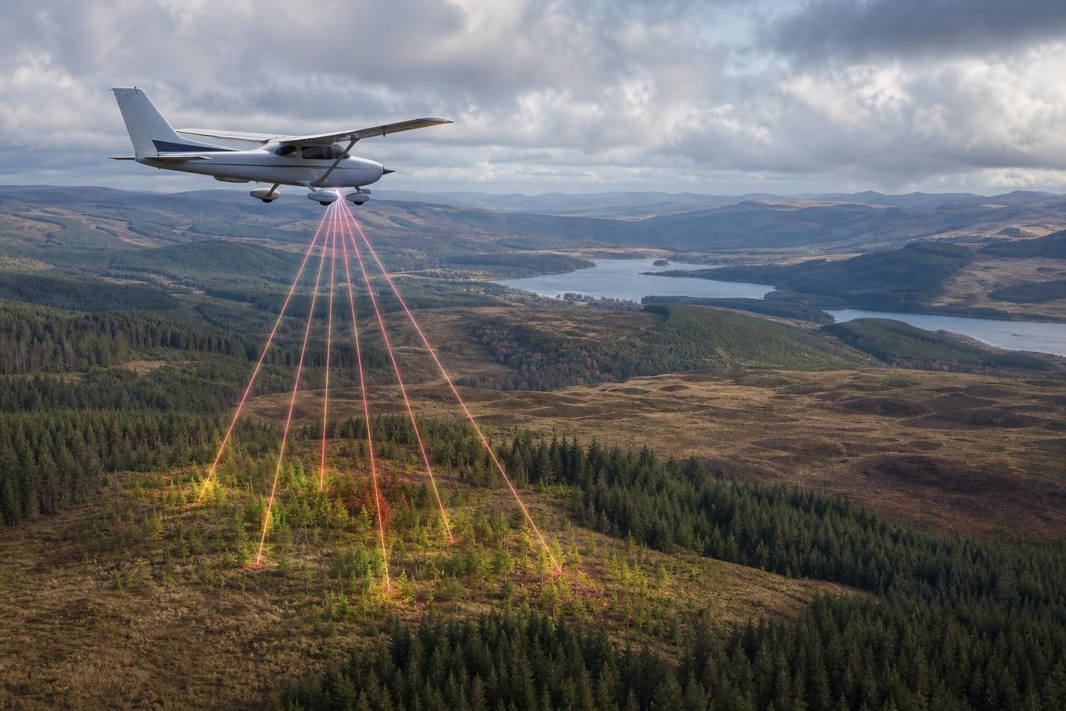
A University of Cambridge-led team used airborne laser scanning to make detailed 3D maps of woodland recovery in Scotland’s Cairngorms National Park, according to reporting by Phys.org. The maps covered 569 square kilometers and identified more than 6 million individual trees, including 2.65 million trees under 5 meters tall. That matters because young trees are the evidence that a forest is not just being protected on paper; it is actually regenerating, or growing back, across the landscape.
The work focused on land managed through Cairngorms Connect, a nature restoration partnership covering 60,000 hectares. A hectare is a metric land area equal to 10,000 square meters, or about two and a half acres. The study found more than 5,235 hectares of formerly open land now supporting young woodland, defined in the article as land with more than 100 trees per hectare. Much of that growth happened naturally rather than through large-scale planting. For people thinking about land-based careers, that is an important distinction: restoration is not only planting trees; it is also changing the conditions so the right trees can establish themselves.
The main technology was airborne LiDAR, which stands for Light Detection and Ranging and uses laser pulses to measure distance. A light aircraft flew about 600 meters, or 2,000 feet, above the ground while the LiDAR system sent laser beams downward. When those beams hit a tree, the ground or another surface, they bounced back to the aircraft. By timing those returns, the system built a three-dimensional picture of the land. Unlike a flat photo, a 3D point cloud, meaning a collection of measured points in space, can show tree height and structure.
That changes the job of forest monitoring. Traditionally, staff and volunteers walk sample areas, record what they see and measure, and then use those samples to estimate what is happening over a larger area. Ground surveys are still important because the Cambridge team used point measurements and field surveys from Cairngorms Connect and RSPB Scotland to check the accuracy of the aerial method. But the new approach can complement or partly replace hundreds of hours of physical survey work. In trade terms, it moves some labor from boots-on-the-ground data collection to remote sensing, data processing, quality control and interpretation.
The maps also show why technical data still needs ecological judgment. Young trees were most common near existing forest edges, where seeds are more likely to fall, but some were found more than half a kilometer away. Habitat type mattered too: fewer young trees had established in boggy areas than on dry heathland. A bog is wet, spongy ground with waterlogged soil, while heathland is open land often covered with low shrubs and tough vegetation. A technician can map both places, but a forester or restoration ecologist has to decide what the map means for future management.
One management issue behind the recovery is deer browsing, which means deer eating young shoots and seedlings before they can grow into trees. The article says deer browsing and the high cost of planting fenced areas have held back woodland expansion in Scotland. Cairngorms Connect has used a landscape-scale approach to deer management, meaning decisions are made across a large connected area rather than one small site at a time. That creates work for wildlife managers, land stewards and forestry crews who must balance tree growth, animal populations, access, safety and long-term habitat goals.
The hiring angle is broader than one job title. This kind of project needs aircraft crews who can operate safely at survey altitude, LiDAR technicians who understand sensor calibration and data capture, GIS specialists who work with geographic information systems to organize location-based data, AI and data analysts who can help identify individual trees, and field technicians who can verify what the computer model reports. It also needs people who can maintain equipment, keep accurate records, follow landowner rules and communicate findings to managers. The article does not list specific job requirements, but the work described points to a mix of outdoor competence, digital mapping skill and scientific reasoning.
The significance goes beyond one park. Scotland’s native coniferous forests have been reduced over centuries by clearance for agriculture and hunting, and the article says only 4% of the original native forests remain. The Scottish Government’s long-term strategy aims to create 3,000 to 5,000 hectares of native woodland across Scotland each year to capture more carbon. Carbon capture here means trees taking carbon dioxide from the air as they grow and storing some of that carbon in wood and soils. If land managers are expected to prove that restoration is working, precise mapping becomes part of the job, not an optional extra.
For a CTE classroom, the story is a useful reminder that environmental work is not separate from skilled technical work. A forest recovery project now depends on aviation, sensors, software, field verification, wildlife management and practical decision-making on the ground. The workers who can connect those pieces are the ones who turn a laser scan into a management plan.
Written from reporting by Phys.org, “Aerial maps reveal successful woodland expansion in Scotland's Cairngorms”.
Discussion questions
- If LiDAR can partly replace hundreds of hours of ground survey work, what should employers keep doing in the field, and what should they move to remote sensing?
- Should natural regeneration be preferred over planting trees when restoring woodland, or should managers use both depending on the site?
- What skills would make a job applicant valuable on a project like this, and which of those skills would be hardest to teach quickly on the job?