
Free activities › Middle school
A Dust Storm Over Mali Shows Weather From Space
A satellite image captured dust over West Africa and showed how wind, land, and climate patterns can connect places far apart.
Print it — all four files
The student packet has no answers in it. The teacher copy is the same pages plus a note on each question and the answer keys. Both languages carry the same story, the same picture and the same vocabulary.
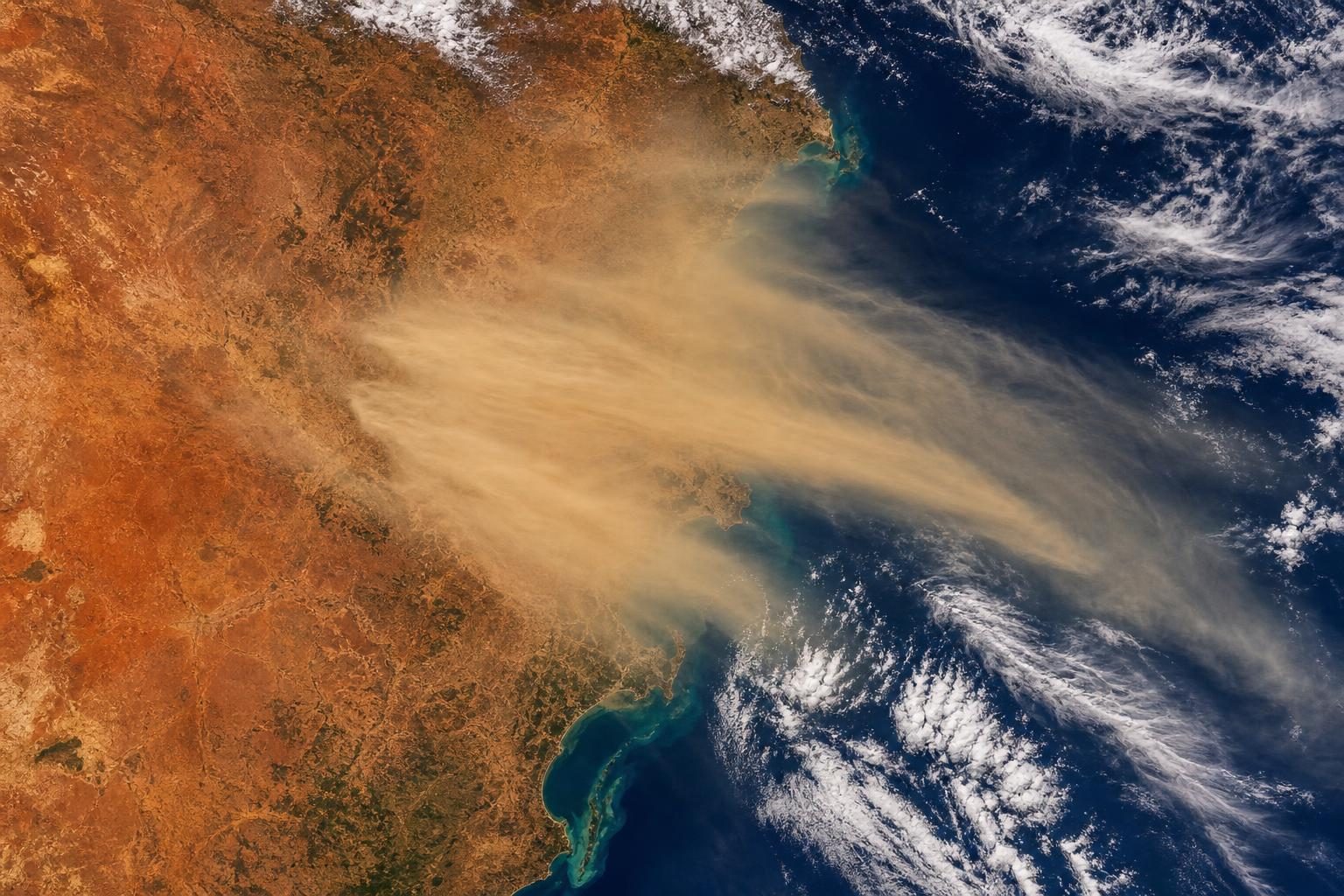
A large dust storm spread across parts of Mali and nearby countries in early September, even though this is usually the time of year when dust activity in West Africa starts to slow down. According to NASA Earth Observatory, NASA’s Terra satellite captured the storm on September 5, 2026, as a broad plume, or long cloud-like stream, of dust covered the region.
Mali is a country in West Africa, near the Sahara Desert and the Sahel. The Sahel is the dry zone along the southern edge of the Sahara. In places like this, loose soil and sand can be lifted by strong winds. When enough dust rises at once, it can block sunlight, reduce visibility, and move across borders. A dust storm does not need a passport.
NASA said storms like this are often linked to haboobs. A haboob is a powerful dust storm pushed by strong convective winds, which are winds caused when warm air rises and cooler air sinks during stormy weather. The satellite instrument that saw the dust is called MODIS, short for Moderate Resolution Imaging Spectroradiometer. It measures light from Earth’s surface and atmosphere so scientists can study clouds, fires, dust, water, and land from space.
That matters because no person standing on the ground can see the full size of a storm like this. A satellite view lets scientists watch where the dust begins, how far it spreads, and what direction it moves. After the September 5 image, a wider view showed aerosols from the region moving west and spilling over the Atlantic Ocean. Aerosols are tiny particles or droplets floating in the air; dust is one kind.
NASA said a full crossing of the Atlantic was unlikely in this case. That kind of long trip happens more often from late spring through summer, when the Saharan Air Layer can carry dust high in the atmosphere for thousands of miles. The Saharan Air Layer is a dry, dusty mass of air that forms over the Sahara and can move westward across the ocean.
Dust may sound like only a local problem, but it is part of a larger Earth system. Winds can carry particles from one continent toward another. Air over land can affect air over the ocean. Dry seasons, storms, and global climate patterns can all change how much dust gets lifted.
One pattern scientists are watching is El Niño, a recurring warming of parts of the Pacific Ocean that can shift weather around the world. NASA atmospheric scientist Tianle Yuan said the developing El Niño could reshape dust patterns near the Sahel and Mali by moving the Intertropical Convergence Zone, a band near the equator where winds from the north and south meet and help storms form.
The connection is not simple. Drier conditions can leave more loose sediment, or small pieces of rock and soil, for winds to pick up. But if there is less stormy air movement, there may be fewer intense dust storms to lift huge plumes in the first place. That is why one storm cannot prove a whole climate trend by itself.
For a class studying Earth science, this is a reminder that weather is not just what happens outside one window. It is motion, energy, land, water, and air interacting over huge distances. A dust storm over Mali can help scientists learn how Earth’s atmosphere works, and satellites give them the view they need to see the whole picture.
Written from reporting by NASA, “Dust Storm Sweeps Over Mali”.
Discussion questions
- Satellite images can show weather events across huge areas, but they do not show what it feels like on the ground. What are the strengths and limits of using space-based images to understand a dust storm?
- NASA says El Niño could affect dust storms in more than one way. Why is it important for scientists to explain uncertainty instead of giving one simple answer?
- Dust from one region can move toward another region or even over an ocean. How should that change the way people think about environmental problems and borders?