
Free activities › Middle school
Ancient Ash Reveals How the Andes Grew
A huge eruption 22 million years ago preserved clues about how one of Earth’s great mountain ranges rose.
Print it — all four files
The student packet has no answers in it. The teacher copy is the same pages plus a note on each question and the answer keys. Both languages carry the same story, the same picture and the same vocabulary.
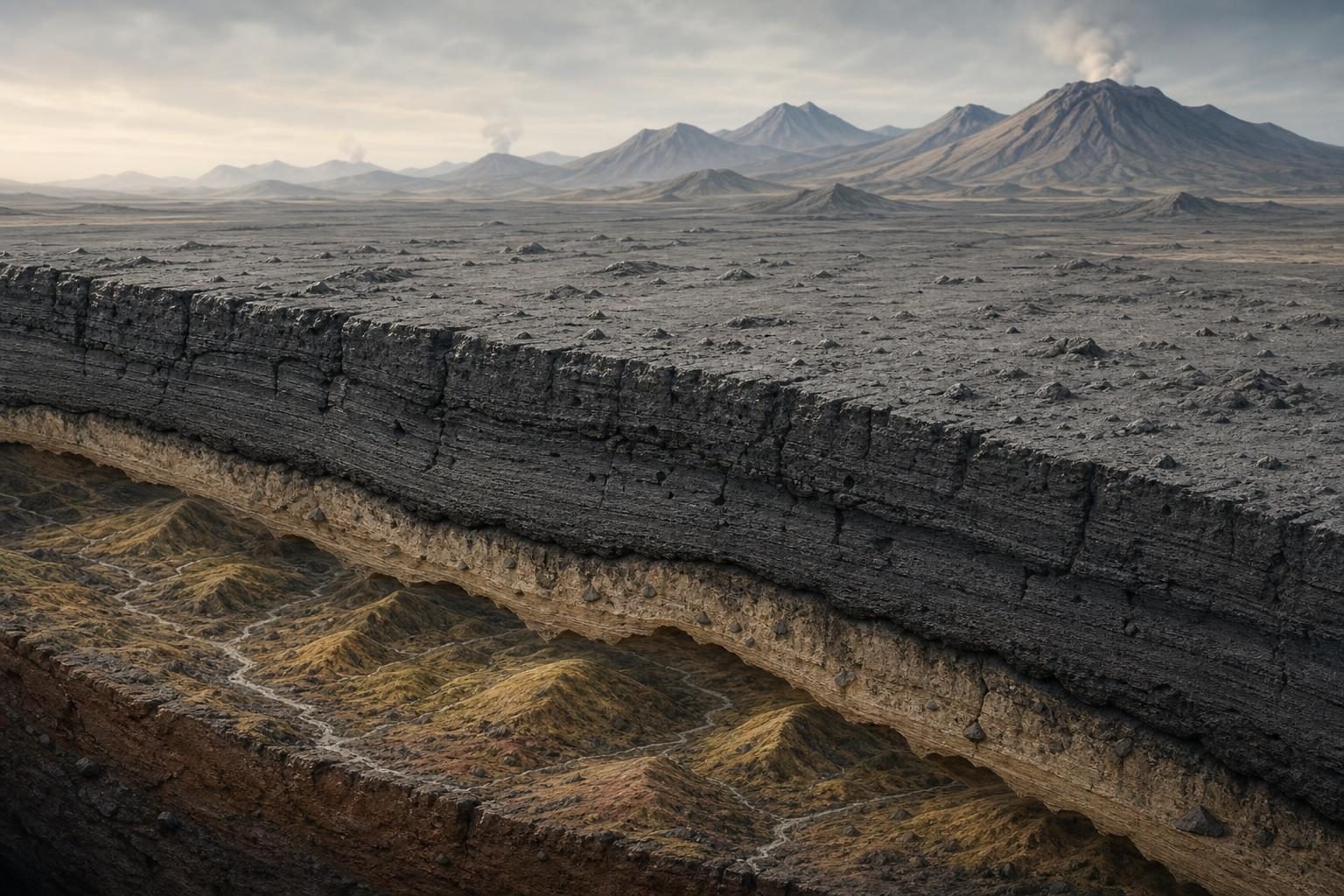
Scientists studying an ancient volcanic eruption in South America say it preserved a hidden picture of the Andes Mountains while they were still forming. According to Live Science, a new study published in the journal Science Advances used a 22-million-year-old blanket of volcanic rock in northern Chile to learn what the land looked like before it was buried.
The eruption came from the Lauca Caldera, a caldera being a large bowl-shaped hollow left after a volcano erupts and collapses. It covered the area with ignimbrite, a type of rock made when hot ash, gas, and broken pieces of rock race across the ground and later harden. That fast-moving cloud is called a pyroclastic flow, which is a deadly mix of volcanic material that can sweep over land like a burning wave.
The scientists compared the site to Pompeii, the Roman town buried by Mount Vesuvius in A.D. 79, because both eruptions froze a moment in time. In this case, the moment was not a city street or a house. It was a whole landscape. The volcanic layer acted like a cover over the land, preserving clues about whether the young Andes were sharp, steep mountains or lower, rolling hills.
The team found evidence that the buried land was more like rolling foothills than tall jagged peaks. That matters because geologists, scientists who study Earth’s rocks and landforms, have debated how the Andes rose. One idea says the mountains grew slowly and steadily over tens of millions of years. Another says they stayed low for a long time and then rose much faster in the last several million years.
The new study supports the slow-and-steady idea. Researchers estimated that before the eruption, the crust was rising no more than 0.16 mile, or 0.26 kilometer, every million years. Crust means Earth’s outer rocky layer. That may sound tiny, but over deep time, which means spans of millions of years, small changes can build giant landforms.
The Andes formed as the oceanic Nazca Plate pushed under the continental crust of South America. Plates are huge moving slabs of Earth’s outer shell. When one plate slides beneath another, the process can help build mountains and feed volcanoes. This is the same kind of Earth process often studied in lessons about plate tectonics, the science of how Earth’s plates move and reshape the planet.
The researchers could not simply dig under the volcanic rock to see the old landscape. Instead, they studied the shape of the volcanic blanket and used what scientists know about rivers and erosion. Erosion is the wearing away of rock and soil by water, wind, ice, or gravity. River patterns can show how steep or gentle a landscape once was, even when that landscape is now buried.
This story matters because it shows that Earth’s surface is not fixed. Mountains that seem permanent are still part of a moving planet. It also shows how scientists answer questions they cannot observe directly. No one watched the Andes rise 22 million years ago. But rocks, slopes, and buried landforms can still hold evidence, if researchers know how to read it.
The same method may help scientists study other mountain ranges around the world. A disaster from the distant past became a record of how a continent changed. In science, even buried landscapes can become evidence.
Written from reporting by Live Science, “South American 'Pompeii': Volcanic eruption 22 million years ago preserved a snapshot of the Andes forming”.
Discussion questions
- Which is more convincing evidence for how mountains formed: direct measurements from today, or clues preserved in ancient rocks? Defend your choice.
- Scientists used a destructive volcanic eruption as useful evidence. How should we think about natural disasters that are dangerous but also teach us about Earth?
- If another mountain range had a similar buried volcanic layer, what would scientists need to know before using the same method there?