
Free activities › Middle school
Pacific Storms Show How Far Weather Can Travel
A busy typhoon season is linking islands in the western Pacific with stormy weather near Alaska.
Print it — all four files
The student packet has no answers in it. The teacher copy is the same pages plus a note on each question and the answer keys. Both languages carry the same story, the same picture and the same vocabulary.
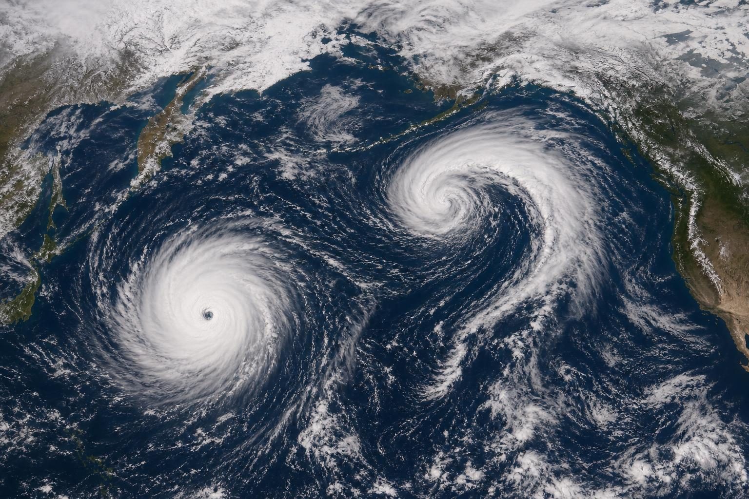
A super typhoon near the Mariana Islands and the leftovers of another typhoon moving toward Alaska showed how active the Pacific Ocean has been this storm season, according to NASA’s Earth Observatory. NASA reported that tropical cyclone activity in the Northwest Pacific has been high since April. A tropical cyclone is a rotating storm that forms over warm ocean water; in the Northwest Pacific, the strongest ones are called typhoons. By late October, 25 named storms had formed after the season’s first super typhoon.
On October 29, a NASA camera in space saw Super Typhoon In-fa near the Mariana Islands, an island chain in the western Pacific that includes Guam and the Northern Mariana Islands. In-fa was the fifth typhoon to affect the Mariana Islands this year. At the same time, the remains of Typhoon Champi were moving toward Alaska as part of a line of storms crossing the Bering Sea, the cold water between Alaska and Russia.
In-fa looked unusual. NASA said the storm had a large, nearly round eye, which is the calmer center of a strong storm. Meteorologists, or scientists who study weather, use that shape to identify an annular storm. Annular means ring-shaped. These storms often look more like a doughnut than the usual spiral storm because they do not have as many outer rainbands, which are curved lines of clouds and rain around the center.
Annular storms are rare. NASA cited an analysis that found they make up only about 4 percent of tropical cyclones in the western North Pacific. Their eyes average about 30 miles across, compared with about 25 kilometers, or about 16 miles, for standard tropical cyclones. NASA said these storms also tend to hold their strength longer when conditions around them become less helpful for a storm.
Champi’s story was different. It began as a powerful typhoon in the western Pacific, with maximum sustained winds of nearly 185 miles per hour. It brought damaging winds and heavy rain to Taiwan, Guam, parts of China, and Japan while it moved through the region. By the time its remnants approached Alaska, the storm had changed through a process called extratropical transition. That means a warm-ocean storm changes into a different kind of storm powered by clashes between warm and cold air.
That change matters because an extratropical storm can spread strong winds over a much wider area, even if the highest winds are not stronger. Alaska did not see the kind of catastrophic damage caused by another ex-typhoon in 2025, but some areas did get high winds, heavy rain, and snowfall. NASA reported that Champi was the fourth ex-typhoon to enter Alaskan waters this year.
One likely reason for the busy season is El Niño, a climate pattern that happens every two to seven years when parts of the equatorial Pacific become warmer than usual. In the Northwest Pacific, El Niño can help storms curve north instead of moving west toward Asia. For a middle school science class, this is a real example of Earth systems working together: warm ocean water, air temperature, wind, satellites, and geography all shape what people experience on the ground.
Written from reporting by NASA, “The Pacific’s Busy Storm Season”.
Discussion questions
- If a place is hit by typhoons more often, how should leaders decide what to spend money on first: stronger buildings, better warning systems, or evacuation plans?
- How does seeing a storm from space change what scientists and communities can understand that they might miss from the ground?
- El Niño can shift where storms travel; how should people talk about that without making it sound like one climate pattern explains everything?