
Free activities › Middle school
Satellite Images Show Gandak River Flooding Nepal and India
Late monsoon rains sent a South Asian river to record levels, flooding farms and settlements along its banks.
Print it — all four files
The student packet has no answers in it. The teacher copy is the same pages plus a note on each question and the answer keys. Both languages carry the same story, the same picture and the same vocabulary.
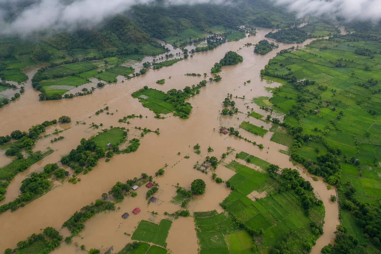
Days of torrential rain, meaning extremely heavy rain, pushed the Gandak River to record levels in parts of Nepal and India, according to NASA’s Earth Observatory. The storms hit Nepal’s mountainous Lumbini and Gandaki provinces between September 24 and 27. Water rushed downhill into the Gandak, also called the Narayani, and flooding spread along the river for hundreds of kilometers. News reports cited by NASA said hundreds of villages were affected and thousands of people were displaced, meaning they had to leave home.
The timing matters. The rain came late in the monsoon season, the part of the year when seasonal winds often bring heavy rain to South Asia. Rivers in mountain regions can rise fast because steep slopes send runoff, or rainwater flowing over land, into channels below. When too much water arrived, it overtopped and broke through embankments, which are raised walls or banks built to hold a river in place. That let water pour into farmland and settlements near the river.
Some flooding happened in places where flooding is expected. NASA said water covered seasonal fields on low, sandy and silty deposits inside the river channel called diara. Silt is fine soil carried by water. People farm these areas because river soil can be rich, but the land is risky when water rises. The flood also reached settled areas, including parts of Bagaha, Areraj, and Fulia Khand. That is the difference between a river filling its usual flood space and a disaster reaching homes and towns.
NASA showed before-and-after satellite images from September 20 and September 29. The images came from MODIS, the Moderate Resolution Imaging Spectroradiometer, an instrument on NASA’s Terra and Aqua satellites that measures different kinds of light from Earth. The pictures use false color, meaning the colors are chosen to reveal details rather than to match what human eyes would see. NASA combined infrared light, which humans cannot see, with visible light to make floodwater appear blue, vegetation bright green, and clouds light blue.
The measurements on the ground were striking, too. NASA said data from Nepal’s Department of Hydrology and Meteorology showed a river gauge at Devghāṭ reached 11.94 meters on September 27. A gauge is a measuring station that records water height. That was the highest level there since measurements began in the 1960s. News reports also said gauges in India along the Gandak set new high-water marks at Bagaha, Dumariaghat, Rewaghat, and Lalganj.
This story matters beyond one river valley because it shows how geography turns weather into risk. Mountains, river channels, farms, towns, and human-made embankments all shape what happens after rain falls. It also shows why data matters. Satellite images can cover huge areas, even when roads are blocked or fields are underwater. River gauges give exact local measurements. Together, they help officials see where flooding is happening and how unusual it is.
A class studying Earth science might know the water cycle as evaporation, condensation, and precipitation. This flood shows the next steps: runoff, erosion, and rivers carrying water and sediment, or pieces of rock and soil. A geography class might ask why people live and farm near rivers if floods can happen. The answer is complicated. Rivers can provide water and fertile soil, but record floods can turn those benefits into danger very quickly.
Written from reporting by NASA, “Rains Swamp the Gandak River”.
Discussion questions
- When a river floods, what are the advantages and limits of using satellite images instead of reports from people on the ground?
- If fertile river land is useful but risky, how should communities decide where farming and housing should be allowed?
- What information is missing from this report that would help judge how well people can recover from the flooding?