
Free activities › Middle school
Southwest Storms Fill a Reservoir—and Bring Flood Risk
NASA satellite images show Navajo Reservoir rising fast after heavy rains, a reminder that drought relief can arrive with danger.
Print it — all four files
The student packet has no answers in it. The teacher copy is the same pages plus a note on each question and the answer keys. Both languages carry the same story, the same picture and the same vocabulary.
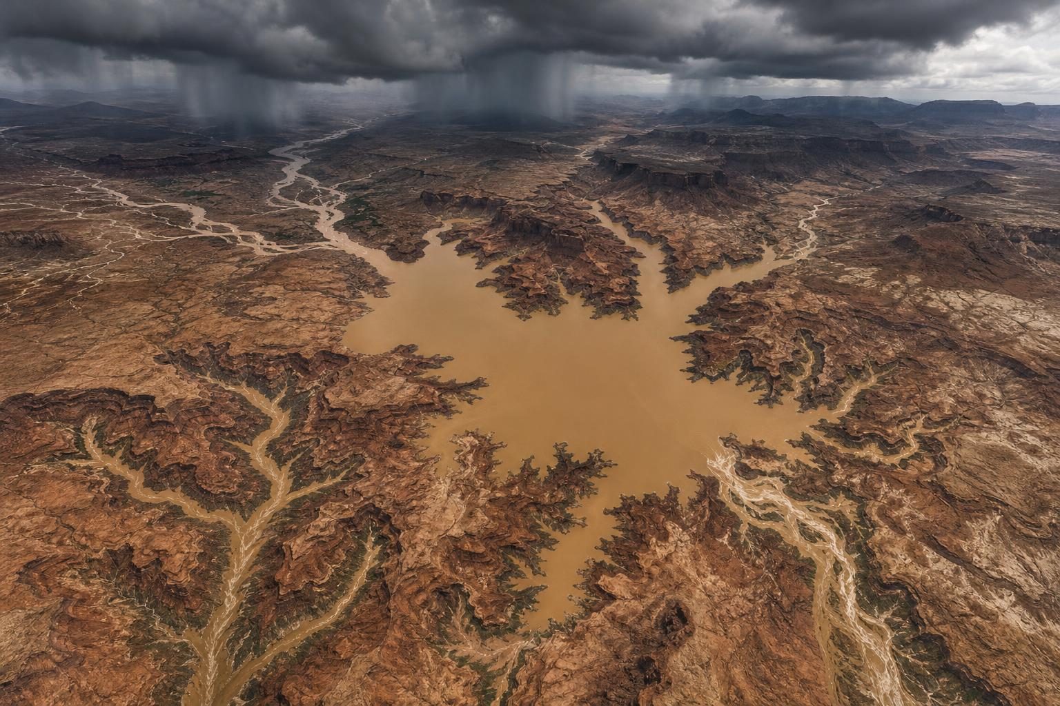
Heavy rain in the U.S. Southwest sent water rushing into Navajo Reservoir, a large lake that stores water behind a dam, in late October and early November. According to NASA Earth Observatory, satellite images showed the reservoir in northern New Mexico and southern Colorado rising by nearly 60 feet between September 20 and November 7. That is about the height of a six-story building.
The change happened after back-to-back extreme rain events soaked the Four Corners region, where Arizona, Colorado, New Mexico, and Utah meet. The storms helped ease short-term drought, which means a recent lack of rain or snow. But the same storms also pushed some rivers to record or near-record levels and caused damaging floods. This is the hard part of water in a dry region: too little water is a problem, but too much water arriving too fast is also a problem.
NASA’s view came from Landsat 9, a satellite that orbits Earth and takes images of land and water. Its camera, called the Operational Land Imager, can show changes that are hard to see from the ground. On September 20, Navajo Reservoir held only 60 percent of its average capacity for that date. By November 7, it stood at 108 percent of its average capacity for that date, its highest level since August 2019. That does not mean the reservoir was 108 percent full. It means it held more water than is typical for that time of year.
The reservoir had stayed low earlier in the year because of snow drought across the West. Snow drought means mountain snowpack is much lower than usual. In many western watersheds, a watershed is an area where water drains into the same river or lake, spring snowmelt often helps refill rivers and reservoirs. In 2026, there was not much spring growth in the lake. Then fall rain changed the picture quickly.
Several rivers, including the San Juan and Piedra, swelled with runoff, which is water flowing over land into streams and rivers. Pagosa Springs, Colorado, along the San Juan River, was hit especially hard. NASA reported that 5.05 inches of rain fell there in the first round of storms. On October 23, the river reached major flood stage, meaning the water was high enough to cause serious flooding. After more rain, it rose again on November 1, almost reaching the record set in 1911.
Across parts of southwest Colorado, southeast Utah, northern Arizona, and northwest New Mexico, rainfall from early September through early November was 2 to 4 times the average. The U.S. Drought Monitor, a weekly report that uses satellite data and ground observations, showed improvement after the storms. Its November 3 summary said short-term drought had ended for the Southwest and Great Basin, though long-term drought still remained in some places.
Scientists also linked the wet pattern to El Niño, a climate pattern in the tropical Pacific Ocean that can affect weather far away. During El Niño, a fast-moving river of air high in the atmosphere, called the jet stream, can help guide wetter storms across the Southwest. NASA said this storm system also drew energy from unusually warm ocean water.
This story matters beyond one reservoir. In Earth science, water is always moving through the water cycle: ocean, air, clouds, rain, rivers, snow, and groundwater. In real life, that cycle affects roads, homes, farms, wildlife, and decisions made by dam managers and emergency officials. Satellite images help people see those changes as they happen, but they do not make the choices easy. A storm can be both relief and danger at the same time.
Written from reporting by NASA, “Water Surges Into Navajo Reservoir”.
Discussion questions
- When a dry region gets sudden heavy rain, should officials focus more on saving as much water as possible or reducing flood danger? Defend your choice.
- How does seeing a reservoir from a satellite change what people can understand compared with only seeing it from the ground?
- What information would be missing if someone only heard that the drought had improved after these storms?